‘When a skua flies towards your face put your hand up and it’ll come close but then fly over the top of your head.’
So advises Sue the Ranger from the National Trust for Scotland about walking around Hirta, the main island of the St Kilda archipelago. It’s an indicator of how much this is an island habitat where birds rule the roost (excuse the pun).
Sue had lost her job on St Kilda during lockdown when no one was visiting. She went back to her old job of being an occupational therapist but now she’s back doing what she loves.
‘We are just coming up to the 91st anniversary of the evacuation so the descendants of St Kildans come back to see where their forefathers lived.’
It feels like I’m on edge of the world here. From here the Atlantic Ocean seems to stretch forever. I imagine myself as one of the thousands of fulmars who call this home or one of the puffins who have already left (July).
To fly due West from here I would get close to the toe of Greenland but finally find landfall in Newfoundland. Somewhere to the North of here are the Faroe Islands, another isolated group of islands. Beyond that is the Arctic Ocean.
There are three main peaks with a bowl hanging in between. Within this are enclosures and cleits and the one street.
These are the highest cliffs in the UK. The cliffs of Conachair. I love that ‘air’ is in that word because that is what I am most aware of here: elevation, space, air. As I edge to the side my legs and feet quiver. Can’t help imagine what it would be like to fall.
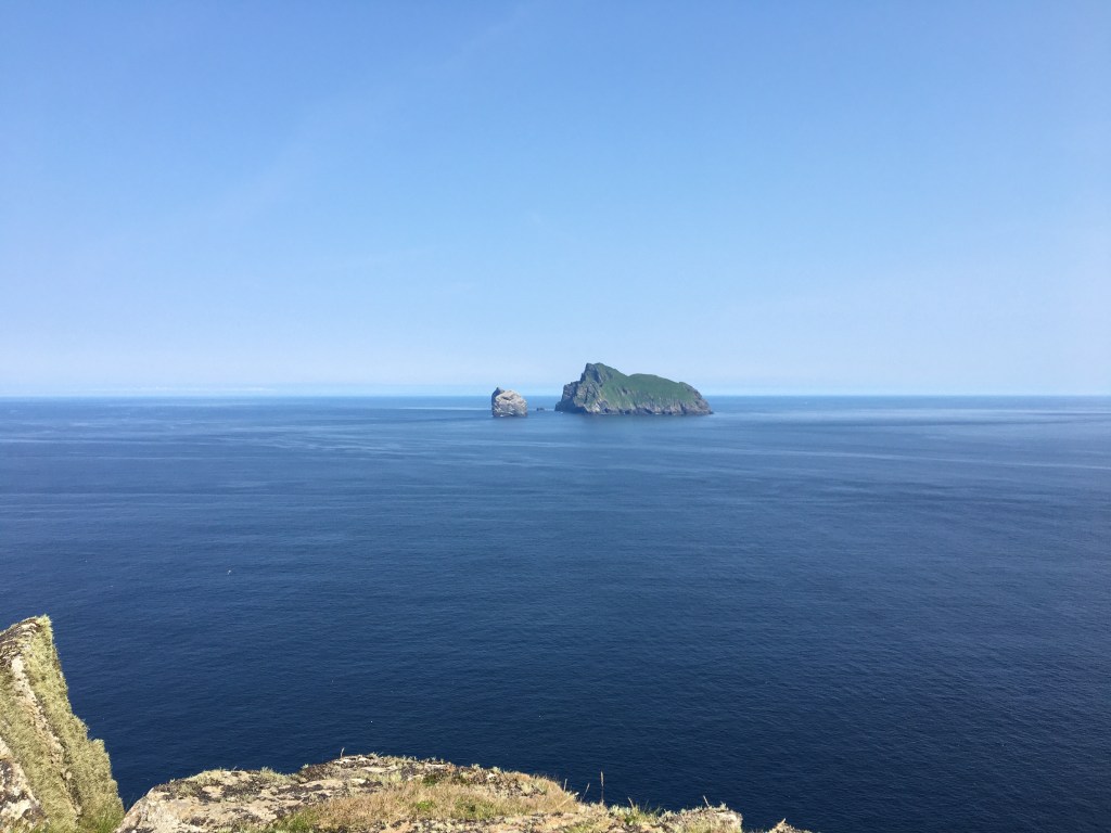
Chattering of fulmars are a bit like geese and a wailing echoes up one of the gullies. Hirta is a horseshoe with two peaks at the end of each prong or peninsula. There’s a short gap at the end of the Southern point and then another island (Dun) which is a sharp ridge of rocks and green rising out of the sea.
A steep ridge rises around the back of the shoe with a mast that listens out for anything that might interest the MOD in the North Atlantic.
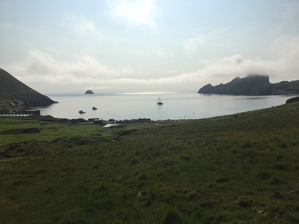
The slopes of the ridge slope down to the U of the bay and as the land flattens is the street – a line of 16 simple one room cottages built of stone in the 1830s where the last inhabitants of St Kilda resided until their evacuation on August 29th 1930. The street is parallel with the beach.

Behind the street is a long dry stone wall that enclosed their livestock.
Dotted all over this land and the hills behind are the dry stone cleits, neat piles of stones that look like ancient burial chambers that were actually where the St Kildans stored the dead fulmars that ensured their survival for so long.

For the UK’s most remote island there is a lot of activity and noise. 2 diggers are hard at work behind the only jetty and next to the Manse.
Sue tells me they are landscaping after having got rid of the original MOD buildings. Instead there are wood clad one storey buildings with of Scandinavian design with turf roofs. These are for employees of Qinetic who Sue tells me now ‘man the mast on behalf of the MoD.’
‘Your walk shouldn’t be compromised by the sheep count that’s going on. Researchers are here to carry out scientific research on the Soay sheep’.
These sheep are native to St Kilda and are named after the small island of Soay (part of the archipelago) and are descended from the breed that would have lived here over a thousand years ago.
I saw the Kirk with its prayer books and austere interior. A plaque on the wall commemorates a captain whose ship registered at Greenock ran aground here. He managed to borrow the St Kilda boat and make his way back to the mainland. He contributed a bell.
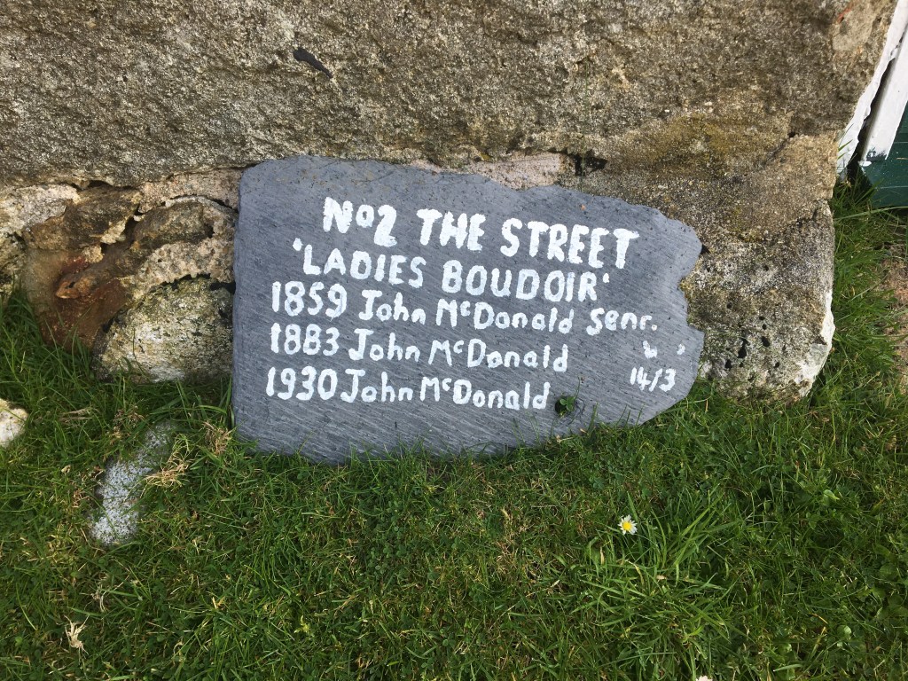
Walked along the street. Each house has the name of the residents including the last person to live there before it was evacuated. Visited the good museum in one of the houses.
After this I went via the beach back to the jetty so that I could find Sue to interview her about tourism and the island.
After lunch I headed up the back of the village to the cliffs. So steep and high like one of my dreams where I am falling from a very great height.
Fulmars swooping wheeling or just sitting on a shelf in the cliff. This is where the men would lower themselves on ropes to slaughter the birds.

Flat blue sea in all directions. Vague outlines of the outer Hebrides are just smoky blue apparitions on the horizon to the south east.
The path follows the top of the cliffs then climbs steeply to the highest peak. There are two rough sheep at the top and a cairn. The sea stretches for miles in every direction. From here across a saddle to the next peak where the mast is. En route a skua flies a few metres over my head.
At the mast I join the road that zig zags back down the hill to the beach. I swim in turquoise sea which Sue tells me is 13 degreees. So hot the cold is like balm then fall asleep on beach.